Background
I was exploring Google Maps when I came across an interesting discrepancy. I found myself looking at “Peckham Liberal Club” in Peckham, London, which is categorized as a “social club” (this is the label that shows up under the venue name on the sidebar). I wanted to see if there were more venues like it.
Naturally, I expected Peckham Liberal Club to show up when I searched “social club” with the London area in focus, but this did not happen. That’s when I realized, searching for a venue type does not actually get you all the venues of that type in the mapbox area. Instead, when you type in the venue type name, it performs some other ranking, possibly treating the query as a regular keyword.
Curious, I wondered if there was a way to do so via some other Google API, like the Places API, instead of through Google Maps. It turns out, not exactly. The Places API does have a venue search, but the actual list of venue types provided is rather thin, and there’s many more unlisted venue types. It can only take in venue types from a fixed list, which “social club” is not in.
However, there does exist the OpenStreetMap API, and unexpectedly it had just what I was looking for. It turns out that there was a big discussion in the OpenStreetMap community about social clubs in particular (there were too many ways to mark it), so it seems like it is an area of focus for the OpenStreetMap dataset. And coincidentally, it seemed UK users were particularly interested in social clubs for some reason! There exist many types unique to the UK, like working mens’ clubs.
The ways in OpenStreetMap:
club=social
amenity=social_club
leisure=social_club
amenity=club
amenity=working_mens_club
so on…
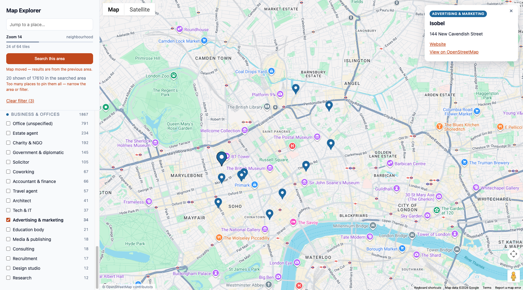
I was able to create an app with Claude Code, which allows the user to center on a specific location, and see all the OpenStreetMap venues of selected types.
Conclusion
I was able to find many more social clubs in London, as well as nearby categories. OpenStreetMap also has hobby club, community centre as categories, just to name a few. This was definitely an improvement over searching “social club” in Google Maps.
- Being curious - poking around, you can discover discrepancies in systems; this is how I realized you can’t actually search for a venue type, even though you expect it work
- Find alternatives - it seems no official Google API was able to do what I wanted, but there were alternatives like OpenStreetMap
- Doing a double take always helps. Sometimes you think something works but it doesn’t (the initial venue type search), or vice versa, that something is not available even though it is (a lot of APIs are closed down nowadays, so it’s surprising when there’s one that still offers a lot of valuable info). It’s always helpful to confirm
- I learned something about the social situation in the process - the fact that people cared enough to talk about it specifically meant there’s a more active social scene than I initially expected happening in these UK clubs